English
 Español
 Deutsch
 日本語
日本語 Polska
 Français
 中國
中國 한국의
한국의 Українська
 Italiano
 Nederlands
 Türkçe
 Português
 Bahasa Indonesia
 Русский
 हिंदी
हिंदीwashington dc cityscape 3D 모델


- 이용 가능한 포맷: Wavefront OBJ: obj 12.11 MB
렌더: Standard
- 폴리곤:216017
- 버텍스:147753
- 애니메이티드:No
- 텍스쳐드:
- 리그드:No
- 재료:
- 프린트 준비:No
- 지오메트리:Polygonal
- 조회:5032
- 날짜: 2013-09-07
- 아이템 ID:74173
- 평점:
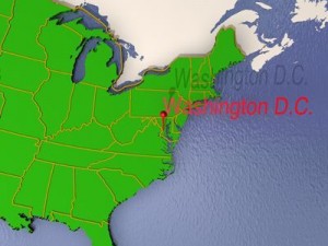
washington, d.c., formally the district of columbia and commonly referred to as washington, \\\"the district\\\", or simply d.c., is the capital of the united states. the signing of the residence act on july 16, 1790, approved the creation of a capital district located along the potomac river on the country's east coast. as permitted by the u.s. constitution, the district is under the exclusive jurisdiction of the united states congress and is therefore not a part of any u.s. state.
the states of maryland and virginia each donated land to form the federal district, which included the preexisting settlements of georgetown and alexandria; however, congress returned the virginia portion in 1846. named in honor of george washington, the city of washington was founded in 1791 to serve as the new national capital. congress created a single municipal government for the whole district of columbia after the american civil war.
washington, d.c., had an estimated population of 632,323 in 2012, the 24th most populous place in the united states. commuters from the surrounding maryland and virginia suburbs raise the city's population to more than one million during the workweek. the washington metropolitan area, of which the district is a part, has a population of 5.7 million, the seventh-largest metropolitan area in the country.
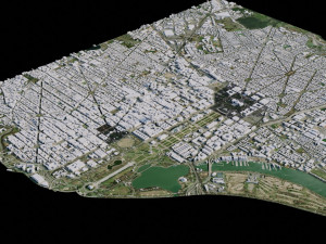
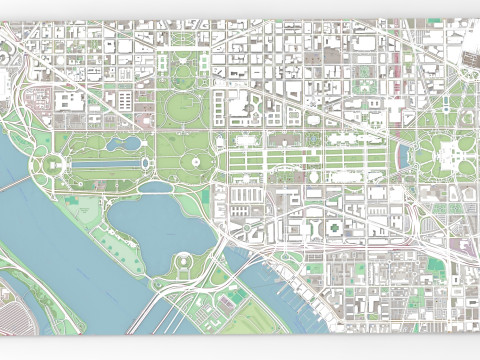
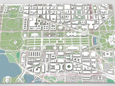
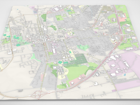
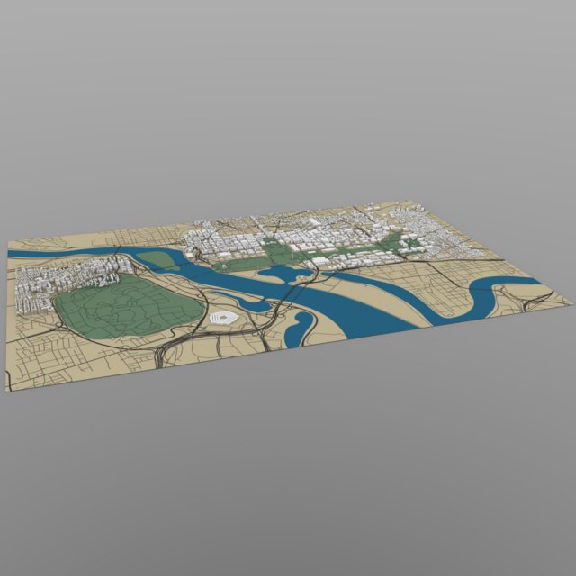
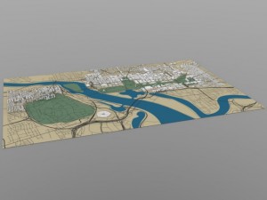
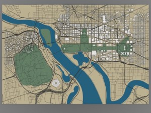
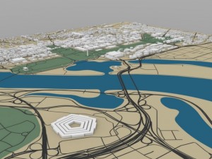
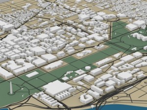
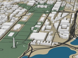
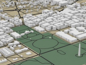
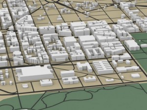
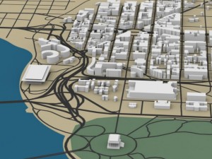
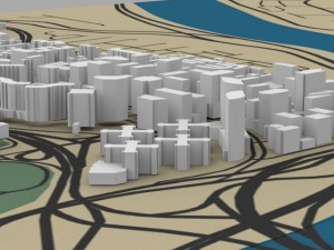
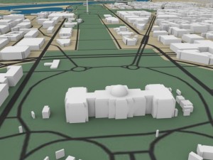
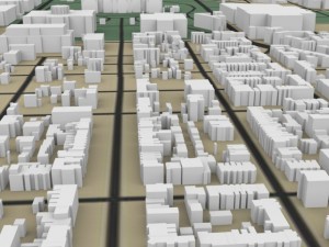
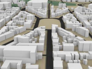
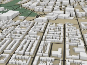
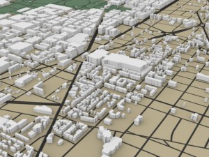
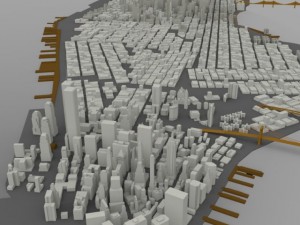
this digital model shows the cityscape of washington, dc with many of its famous buildings, including the white house, washington monument, us capitol, smithsonian museums, pentagon, lincoln memorial, lincoln center, and surrounding offices and homes in dc and virginia.
all of the (white) buildings are modelled, but the terrain (green, brown, and blue) is a texture map/ not modelled.
note: this model is meant for distance and overview shots.
product features (wavefront obj):
- approx 216017 polygons.
- includes grouping information: the buildings are separated into individual and clustered groups.
- this version includes an mtl file, which your software program should read to colorize the model.
- the model has basic uv mapping.
- the model includes one texture (in jpg format) for the terrain
- the buildings are not textured. 프린트 준비: 아니오
더 보기the states of maryland and virginia each donated land to form the federal district, which included the preexisting settlements of georgetown and alexandria; however, congress returned the virginia portion in 1846. named in honor of george washington, the city of washington was founded in 1791 to serve as the new national capital. congress created a single municipal government for the whole district of columbia after the american civil war.
washington, d.c., had an estimated population of 632,323 in 2012, the 24th most populous place in the united states. commuters from the surrounding maryland and virginia suburbs raise the city's population to more than one million during the workweek. the washington metropolitan area, of which the district is a part, has a population of 5.7 million, the seventh-largest metropolitan area in the country.
this digital model shows the cityscape of washington, dc with many of its famous buildings, including the white house, washington monument, us capitol, smithsonian museums, pentagon, lincoln memorial, lincoln center, and surrounding offices and homes in dc and virginia.
all of the (white) buildings are modelled, but the terrain (green, brown, and blue) is a texture map/ not modelled.
note: this model is meant for distance and overview shots.
product features (wavefront obj):
- approx 216017 polygons.
- includes grouping information: the buildings are separated into individual and clustered groups.
- this version includes an mtl file, which your software program should read to colorize the model.
- the model has basic uv mapping.
- the model includes one texture (in jpg format) for the terrain
- the buildings are not textured. 프린트 준비: 아니오
다른 포맷이 필요하세요?
다른 포맷이 필요하시면, 새로운 지원 티켓을 열어 요청하세요. 저희는 3D 모델을 다음으로 변환할 수 있습니다: .stl, .c4d, .obj, .fbx, .ma/.mb, .3ds, .3dm, .dxf/.dwg, .max. .blend, .skp, .glb. 우리는 3D 장면을 변환하지 않습니다 .step, .iges, .stp, .sldprt와 같은 형식도 포함됩니다.!
다른 포맷이 필요하시면, 새로운 지원 티켓을 열어 요청하세요. 저희는 3D 모델을 다음으로 변환할 수 있습니다: .stl, .c4d, .obj, .fbx, .ma/.mb, .3ds, .3dm, .dxf/.dwg, .max. .blend, .skp, .glb. 우리는 3D 장면을 변환하지 않습니다 .step, .iges, .stp, .sldprt와 같은 형식도 포함됩니다.!
다운로드 washington dc cityscape 3D 모델 obj 발신 Digimation
city cityscape skyline buildings washington capital government이 아이템에 대한 코멘트 없음.